


Last year, around five thousand people were displaced by the rising water level of Lake Naivasha, 50 kilometres from Nairobi. Similarly happened on Lakes Nakuru and Lake Baringo, located further north, where several dwellings, schools and tourist lodges were submerged. Here as well thousands of people were forced to relocate.
Lake Baringo, one of the most affected by water levels rise, has expanded 50% from 160 square kilometres 10-15 years ago to 250 square kilometres today. Besides being a social and economic problem, this entails serious environmental impacts.
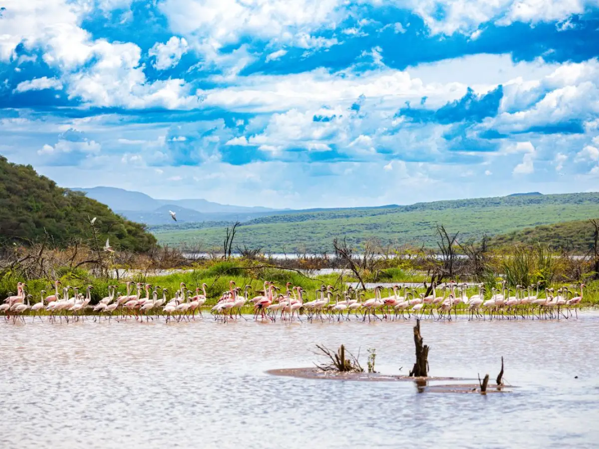
“The rise in water levels endangers biodiversity: Lake Baringo was home to thousands of flamingos, which do not come here anymore”, explains Dario Cipolla, head of Agriculture, Rural Development and Environment at the AICS office in Nairobi. “This phenomenon also disrupts habitats, triggering conflicts between humans and wildlife. This is the case of hippos, which now move too close to a school on the lake shore.”
What is causing this rise? There are two competing theories: according to the first, the rise is a consequence of tectonic plate movements in a geologically dynamic area such as the Rift Valley. “The second links the rise of water levels to soil erosion throughout the basin, caused by overgrazing, unsustainable agriculture and deforestation”, continues Cipolla. “The loss of vegetation cover causes soil impermeability. Combined with the increased rainfall of the last ten years (that is also concentrated in shorter periods of times), this leads to reduced absorption of rainwater by the soil and a consequent increase in rainwater and sediment inflows into the lake.”
The contraction of the so-called sponge effect — exacerbated by more intense rainfall and reduced absorption capacity of the soil — leads to a paradox: instead of stimulating soil fertility, excess rain causes desertification. A bleak picture, according to the AICS expert. “In fact, rainfall not only raises lake levels but also washes away the topsoil. Runoffs remove the fertile part of the soil — five, ten, twenty centimetres — and creates an impermeable layer. Finally, the debris fills the lake basins, further increasing water levels.” In lakes with particularly steep slopes, such as Lake Baringo, up to 200 tonnes of sediment per hectare per year of sediment can be washed away. This leads to another perverse consequence: the load of sediment that fills the lakes of the Rift Valley also contributes to sealing the lake beds, hampering the recharge of groundwater.
There is yet another risk for Lake Baringo. Due to rising water levels, the distance between Lake Baringo and nearby Lake Bogoria, a saline and alkaline lake contained in a semi-granitic basin, has been decreasing from 22 to 13 kilometres. Their proximity and the small difference in altitude, just over twenty metres, increase the likelihood of a direct connection, that entails very serious risks. “If the waters of Lake Bogoria, whose level is soaring, were to overflow in the fish-rich Lake Baringo, they would trigger an environmental and economic catastrophe. The waters of Lake Bogoria are highly alkaline, with a conductivity of 33,000 microsiemens, and salty. The overflow would impact fishing and biodiversity, affecting particularly crocodiles, hippos and other mammals."
Ecosystem restoration
As a consequence, interventions must address a variety of factors. While rainfall cannot be controlled, it is possible to intervene on desertification and erosion, combat deforestation, control water resources and secure infrastructure.
“Together with GIZ, AICS Nairobi began planning numerous activities, with a delegated cooperation project funded by the European Union with over €14 million, which will start on 1 March 2026. This include developing check dam and terracing aimed at reducing the inflow of water into the lake, as well as restoring pasture vegetation and soil permeability so that the aquifer can be recharged. Over the next four years, we will implement many actions along these lines”, explains Cipolla.
This involves working on the agricultural landscape, with systems of furrows and wells to retain water in designated areas for use in growing crops such as maize, beans, cassava, sorghum, pigeon peas and millet. “We try to work with nomadic herding communities, providing training to teach them how to harness these water infrastructures for sedentary agriculture.”
“Together with GIZ, AICS will seek to link environmental improvement and protection with growing income for farmers through nature-based solutions: this includes, among others, honey production, legal and regulated charcoal production, rotational grazing and fodder sowing. These solutions will be adopted in consultation with farming and pastoral communities”, comments Cipolla.
In order to find additional sources of income for pastoralists, the project will also try to follow the example of the Northern Rangeland Trust. This Kenyan NGO protects rangelands and local communities through participatory conservation, with the aim of creating carbon credits from pastoral lands. This can strengthen pastoralism from an economic point of view and protect biodiversity restoration work. The increase in carbon in the soil (pasture rotation, rest, reforestation) will be counted. An agency measures and certifies the additional CO₂ absorption, and carbon credits can be generated and sold on the financial market to offset emissions from greenhouse gas-intensive activities, generating resources for farmers. In short, the challenge is to combine environmental protection, water resilience and economic development in pastoral areas: a symbolic project in the International Year of Rangelands and Pastoralists.
This article was originally published on Oltremare.
Cover: Lake Bogoria, Envato